Our Links:
External Links:
Enter a key word to search for posts:Ever wondered where we are?
Posted on: Monday October 26, 2020 at: 2:18 pm
This is a screenshot of the navigation map we use while cruising, showing a section of the West Midlands. The map has all the waterways of England and Wales and is full of very detailed information. Normally, the view I use would be zoomed in a lot closer than this image, but I wanted to show a more general picture of our travels. It also shows you just how many canals there are around Birmingham – more miles of canals than Venice.
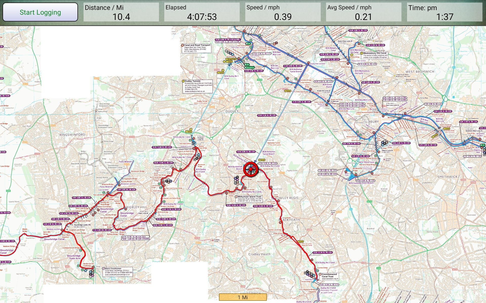
Map around Birmingham
The red circle is us, and the red lines are where we have travelled in the last four days – apart from Saturday. The weather was going to be so bad on Saturday that we decided to stay put – and watch the Ireland v Italy Six nations match of course!
The lines indicate where we have travelled out and back along the arms, not least to add them to our list of places visited. The blue lines to the North are firstly a long tunnel (almost two miles) which will take us onto the Birmingham main line and then into the centre of Birmingham itself, via the Birmingham NIA and ICC. We may moor up overnight by the NIA as long as we can be sure of social distancing. Then down the Worcester and Birmingham canal and back to Droitwich where we are currently based.
One of the big advantages of being out at this time of year, is that there are very few boats on the move. That means no, or at least less, queuing at locks and no problems finding moorings.
WHEN IN DUDLEY LOOK OUT FOR L.ENNY HENRY AS IT IS HIS HOME TOWN HOPE YOU MANAGED TO DODGE THE SHOWERS…AND SEE A FEW RAINBOWS. XX